In the realm of infrastructure development, precision and efficiency are paramount. Traditional methods of corridor mapping for roads, railways, pipelines, and other linear infrastructure have often been time-consuming, labour-intensive, and costly. Enter drones: these aerial marvels are revolutionizing corridor mapping by providing high-resolution imagery, accurate topographic data, and real-time updates with unparalleled speed and precision. Drones equipped with advanced sensors and cameras can capture detailed information over extensive areas, significantly enhancing the planning, design, and monitoring phases of infrastructure projects.
Drones not only reduce the time and resources required for corridor mapping but also improve safety by minimizing the need for human presence in hazardous areas. Their ability to quickly gather comprehensive data enables engineers and planners to make informed decisions, optimize routes, and detect potential issues before they become significant problems. This technological leap forward is transforming how infrastructure projects are approached and executed.
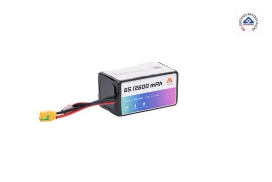
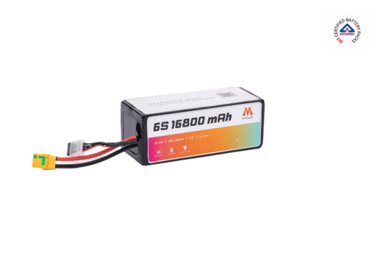
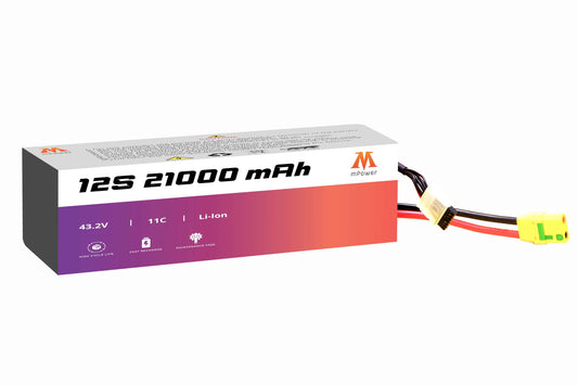
Reliable power sources are crucial to fully capitalize on drone technology's benefits in corridor mapping. Drone batteries need to provide the necessary endurance and efficiency to keep drones operational for extended periods. mPower batteries for drone, designed for high-performance drones, ensure that your drones remain airborne and effective.
Drones Take Flight: A New Era for Corridor Mapping
Drones, also known as Unmanned Aerial Vehicles (UAVs), are revolutionizing how we approach corridor mapping. These versatile aerial platforms offer a suite of advantages that streamline the process and enhance data quality. Here's how drones are changing the game:
- Enhanced Efficiency: Drones can map vast stretches of land in a fraction of the time it takes traditional methods. They can cover miles in a single flight, significantly reducing project timelines and labour costs.
- Improved Safety: Drones eliminate the need for surveyors to be physically present in hazardous areas. This minimizes the risk of accidents and injuries, keeping project teams safe.
- Unprecedented Accessibility: Drones can easily navigate steep slopes, dense vegetation, and uneven terrain, capturing data from previously inaccessible areas.
- High-Precision Data: Equipped with advanced sensors like LiDAR (Light Detection and Ranging) and high-resolution cameras, drones capture detailed and accurate data, leading to more informed decision-making.
Benefits of Drone-Based Corridor Mapping
The impact of drones goes beyond just faster and safer data collection. Here are some additional advantages that benefit infrastructure projects:
- 3D Modeling: Drone-captured data allows for the creation of highly accurate 3D models of the corridor. This provides engineers with a clear visualization of the terrain, enabling them to plan construction phases and identify potential challenges more effectively.
- Improved Cost Estimation: Accurate data from drone surveys leads to more precise estimations of materials and labour needed during construction. This translates to better cost management and reduced project overruns.
- Enhanced Communication & Collaboration: 3D models and high-resolution imagery captured by drones facilitate better communication and collaboration between different project stakeholders. This streamlines decision-making and ensures everyone is on the same page.
- Environmental Benefits: Drones have a lower environmental impact compared to traditional methods that rely on heavy machinery. Their efficient data collection reduces the need for physical disturbance to the environment.
Importance of Battery Life in Drone-Based Corridor Mapping
One crucial factor for successful drone-based corridor mapping is battery life. Since these projects often cover long distances, drones equipped with high-capacity batteries capable of extended flight times are essential. Lithium-ion batteries, based on futuristic technology with high energy density, are becoming increasingly popular for corridor mapping drones, offering a good balance between power output and flight duration. However, advancements in battery technology, such as the development of solid-state batteries, promise even longer flight times and improved safety features in the future.
Conclusion
In essence, drones have become a game-changer for corridor mapping in infrastructure projects. Their unmatched precision, efficiency, and safety are revolutionizing the way we capture high-resolution imagery and detailed topographic data across vast areas. This translates to a complete transformation of planning, design, and monitoring processes. However, to fully unlock the potential of these flying workhorses, reliable power is paramount. High-performance batteries for drone, with extended flight times and dependable operation, are crucial for keeping these advanced machines airborne for the duration of the project. By prioritizing long-lasting and efficient batteries, you can ensure your drones deliver optimal performance, maximizing the efficiency and effectiveness of your corridor mapping initiatives. Visit mPower now.


